 ADSCivil
ADSCivil 2024 Survey - Editing and processing topographic and geotechnical survey data
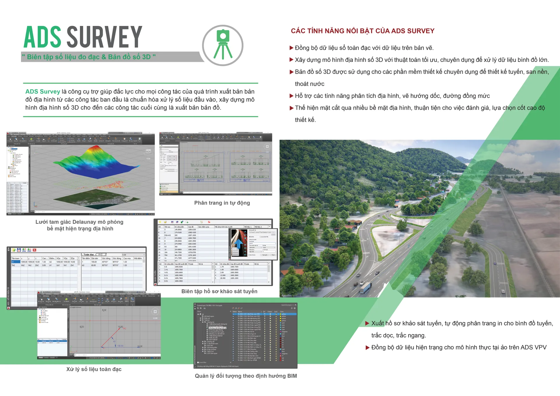
Software that supports topographic map editing. ADSCivil Survey is a powerful aid to the survey engineer throughout the process, from collecting measurements in the field to producing the finished survey documentation.
01 — Introduction
Software that supports topographic map editing. ADSCivil Survey is a powerful aid to the survey engineer throughout the process, from collecting measurements in the field to producing the finished survey documentation.
02 — Overview
COMPREHENSIVE TOPOGRAPHIC MAPPING SOFTWARE FOR ALL OFFICE AND FIELD WORK
- Covers every topographic survey task in full, from reading the survey data through editing to producing the finished survey documentation
- Because it covers everything, users need no other software. This keeps data consistent and intact throughout the project
- The survey data workflow is designed logically and systematically, offering the fullest set of features while remaining simple and approachable even for first-time users
03 — Benefits
ADSCivil Survey does more than provide the digital base map for the design software in the ADSCivil ecosystem — it works closely with those applications to build finished works surfaces:
- Building the works design surface: outside the design boundary the surface uses the existing ground data, combined with the design data inside the boundary
- Building the planning surface for site grading design
04 — Features
CONSOLIDATING SURVEY DATA
Every kind of survey data can be edited and standardised so it can be used together accurately and completely:
- Total station survey data
- Point cloud survey data
- Coordinate survey data
- Survey data digitised from cadastral maps
- Survey data converted from CAD platforms (AutoCAD, MicroStation and so on)
ADSCivil Survey combines different measurement methods and instruments so the project's survey area can be divided between several teams working at once. This makes the fullest use of the company's resources and can speed up delivery when the programme is tight.
Data can also be separated in several different ways: a separate measurement method for each area, or several methods within the same area.
INSERTING AND LINKING FEATURES
In survey work, inserting and linking features is central to reproducing the surveyed area accurately. For this critical office task ADSCivil Survey provides a range of capabilities that make map editing far more productive:
- Automatic point joining by annotation code group
- Filtering the display of survey points by annotation code group
- Automatic feature insertion from a user-configurable description code table
- Referencing features from the plan onto the route's longitudinal and cross sections
Having complete information on existing features — houses, communal houses, temples and so on — keeps design options optimal with respect to the design boundary.
EDITING MEASUREMENT DATA
Errors regularly appear while measurements are being collected. Station errors, for example, produce a whole series of discrepancies in the results for detail points
Rather than remeasuring in the field, which costs a great deal of time and money, users can use the tools already in ADSCivil Survey to edit and process the erroneous data and put it back to use
- Transferring points between instrument stations
- Updating instrument station and backsight coordinates
Once they have mastered the data editing features in ADSCivil Survey, users can take shortcuts through field work and make good the data in the office instead. This saves a great deal of field effort and cost and helps speed up project delivery.